In the heart of Silicon Valley, the world’s biggest tech companies are expanding their headquarters on the edges of San Francisco Bay.
Google has bought more than 70 properties in the past five years in Sunnyvale to expand its campus, worth almost $3 billion.
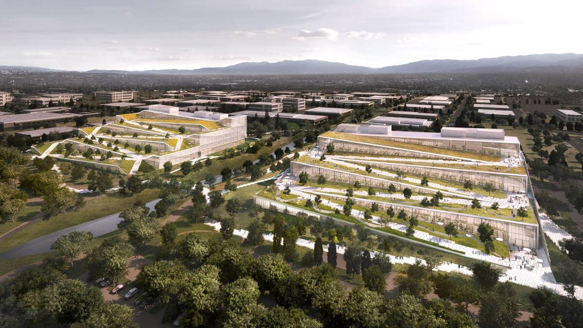
Farther north, Facebook has acquired properties now worth more than $2.5 billion in the last decade.
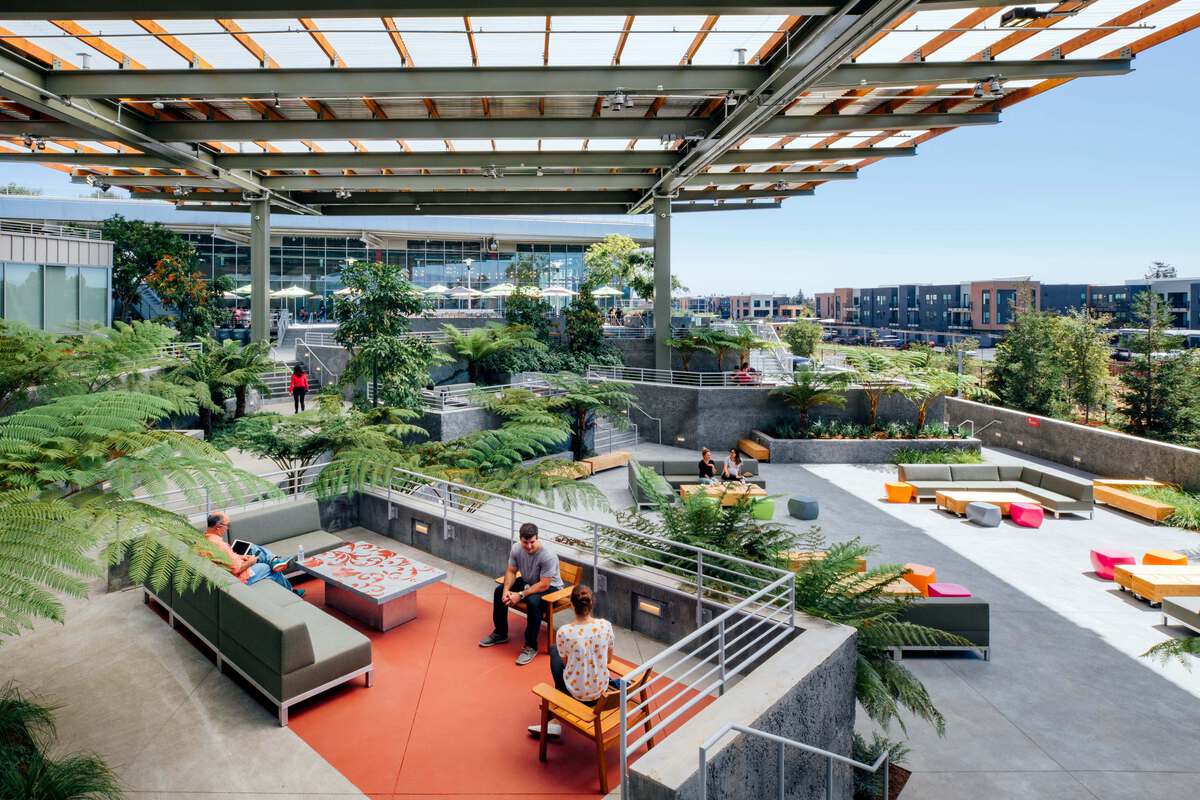
The company has built a state-of-the-art campus, designed by world-renowned architect Frank Gehry.
 Facebook
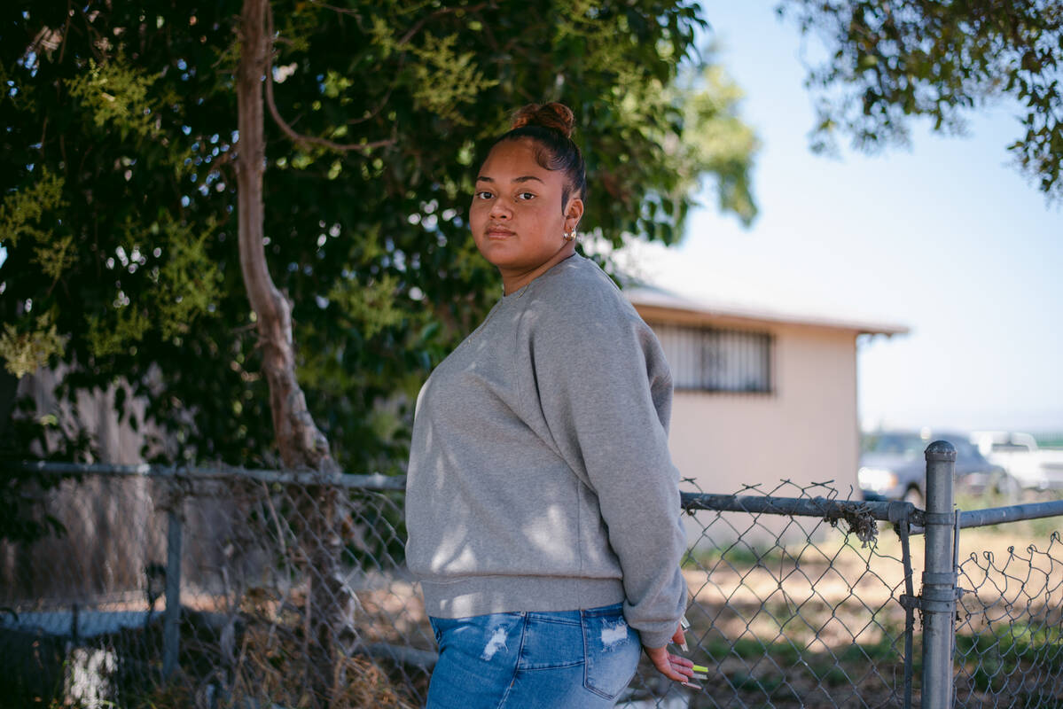
Nearby, some of the few low-income communities in Silicon Valley are also vulnerable to flooding.
Google’s campus is at risk, too.
Local governments are planning to build massive levee projects to hold the water back, costing hundreds of millions of dollars.
The price is more than they can afford.
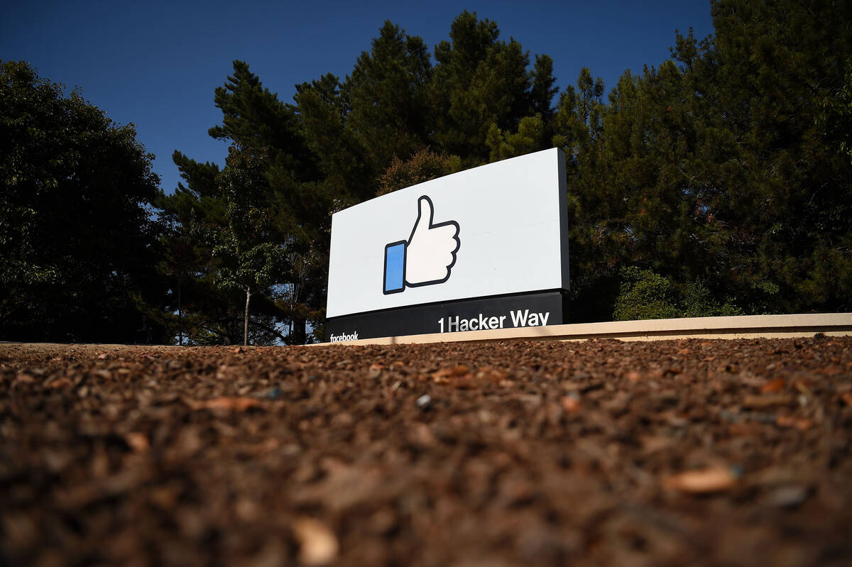
The entrance to Facebook’s headquarters in Menlo Park is marked by a piece of Silicon Valley iconography. It’s a huge thumbs-up, taller than a person, the symbol used as the social media giant’s “like” button. It’s not unusual to see people taking selfies in front of it.
 Josh Edelson/AFP via Getty Images
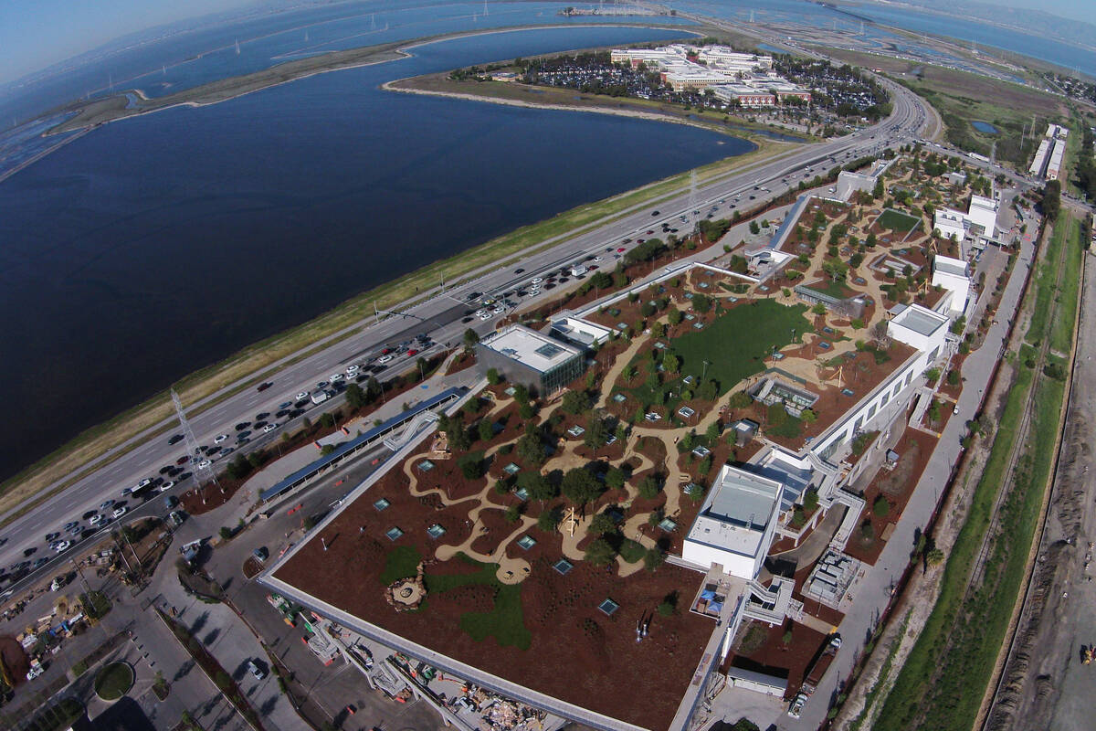
The rest of the campus is bordered by something less eye-catching: a 9-foot-tall earthen berm. It’s the barrier that protects Facebook’s east campus, 1 million square feet of office space on land that juts into San Francisco Bay.
“Some people refer to them as levees, but they’re really just mounds of dirt,” says Kevin Murray, senior project manager with the San Francisquito Creek Joint Powers Authority, an agency that works on flood protection in the area.
Facebook’s shoreline campus, along with surrounding roads, homes and businesses, depends on levees that were never designed to protect people. In the 1940s, salt-making companies mounded up mud to form large ponds where bay water evaporated, leaving behind crystalline salt.
Over the years, government agencies have maintained the levees. But the whole region is considered a flood zone because the levees weren’t constructed to meet safety standards, which the Federal Emergency Management Agency created to ensure the barriers can withstand extreme storms.
“We know that the structures that are providing flood barrier now are not adequate and are subject to failure if we have a really big tide or a big wind event or a big storm surge,” Murray says.

Climate change is only increasing that risk.
San Francisco Bay has already risen almost 8 inches in the past century. By 2050, the bay is expected to rise between 0.9 feet and 1.9 feet, depending on how much more greenhouse gas pollution humans emit.
By the end of the century, the water could be as much as 5 feet higher or more, if emissions don’t fall.
Coastal cities grapple with "fair share"
Like Facebook’s campus, billions of dollars of new coastal development is on land that will inevitably become ocean in a hotter climate. Many projects were built even after those risks were well-understood.
To stop the water, cities are looking at installing multibillion-dollar defenses on their shorelines. But those plans vastly outstrip their ability to pay. That has local governments struggling to figure out who bears the cost of climate change.
Most cities are looking to federal funding since large amounts of public infrastructure are at risk, such as roads, power lines and wastewater treatment plants. But competition for those resources is growing.
“It’s going to be trillions of dollars, in my opinion, just in the United States,” says Mark Lubell, professor of environmental science and policy at the University of California, Davis. “Even if you added up all the state and federal money that’s out there, it doesn’t pay that price tag.”
As a result, many cities are considering raising taxes. It’s a heavy lift in most communities, and it inevitably raises questions about who should contribute to protecting against sea level rise. Should all residents pay? Or should more of the cost be shouldered by private landowners on the shoreline, who would benefit the most and in some cases, who knowingly put themselves at risk?
Weighing these questions, local governments are in the uncharted territory of climate change accountability. Everyone has differing ideas of what’s fair.
“Is fair share based on how much risk you’re facing?” asks A.R. Siders, assistant professor at the University of Delaware’s Disaster Research Center. “Is it based on your ability to pay? This is a problem because there’s no scientific answer. This is ethics. This is personal values.”
 Facebook has expanded its headquarters along the waterfront twice in the last decade.
Facebook
Facebook has expanded its headquarters along the waterfront twice in the last decade.
Facebook
Flood risk was clear when Facebook first moved in
In 2011, Facebook took over the former buildings of Sun Microsystems in Menlo Park for its east campus on the bay front, full of the dining, gyms and other perks tech companies offer. Then the company constructed a new building, designed by architect Frank Gehry, featuring a 9-acre green roof with full-grown trees.
In 2016, Facebook began a second expansion, also designed by Gehry, that added two more buildings with almost 1 million square feet of space. Altogether, the properties are valued at more than $2.5 billion, according to recent tax records. The company is still expanding.
Attracting Facebook meant jobs for Menlo Park. Under an agreement, the company also paid several million dollars in fees for local infrastructure and community benefits as well as continuing annual payments to the city of around $1 million.
To build both expansions, Facebook needed approval from the city in 2011 and 2016, which required environmental analyses of the projects.
Consulting firms paid for by Facebook issued the environmental assessments, and they highlighted the risk of being on the water.
The entire site “is subject to tidal flooding from the Bay,” the 2011 report reads and “could be inundated with a sea level rise of 16 inches, which might be expected to occur by mid-century.” The 2016 report notes that Facebook’s campus is “particularly vulnerable” to sea level rise, which "would dramatically increase the risk of flooding.”
The community noticed the warnings.
“Please explain how Facebook is planning to improve existing levees and flood protection systems to mitigate the potential threat of flooding due to tidal flooding, including the effects of Sea Level Rise,” then-East Palo Alto City Manager Carlos Martinez wrote in a public letter at the time.
Facebook offered a solution: The first floor of its new buildings would be elevated by 12 feet, keeping it dry in a flood, at least until sea level rise gets dramatically worse after midcentury. That wouldn’t protect the surrounding area, the environmental analysis said, since the “parking areas and roadways, including underground parking areas, would be inundated.”
Preparing for sea level rise wasn’t legally required for Facebook, the environmental assessment noted. California has one of the strictest laws in the country requiring environmental impacts to be analyzed before a project is built. But according to recent court cases, its scope is limited around sea level rise. Construction projects must account for damage they cause to the environment, but not the damage the environment could cause to them.
Cities face aging levees and sea level rise
With billions of dollars of real estate at stake as well as major roads and power lines, Menlo Park and neighboring cities are opting to defend their shoreline.
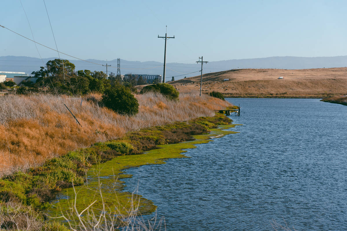
Work is already underway. The old salt ponds outside of Facebook’s campus, some still coated in a white, mineral crust, are being restored to the marshes they once were. Plants and tidal channels will create vital habitat for migratory birds and other animals, part of an effort to bring back 15,000 acres of wetlands through the South Bay Salt Pond Restoration Project.
The marshes provide another big benefit: They protect the shoreline from flooding.
“You can think of it as a sponge,” says Dave Halsing, executive project manager of the restoration, as he watches trucks bring fresh dirt to the work site. “If you have a healthy, functioning marsh in front of the levee, it absorbs a lot of that wave energy. It diffuses it and slows it down.”
The entire restoration effort will cost hundreds of millions of dollars. Funding has come so far from federal, state and local sources. But raising money continues to be a challenge. So several years ago, the restoration project started conversations with the tech companies on their doorstep, such as Facebook.
 Former salt ponds are being restored to tidal marsh, providing flood protection for Menlo Park.
Lauren Sommer/NPR
Former salt ponds are being restored to tidal marsh, providing flood protection for Menlo Park.
Lauren Sommer/NPR
“We were always well-received,” says John Bourgeois, who led the restoration project at the time. “But then when we tried to translate that into more direct funding support or partnerships, that’s where things started to get complicated.”
Facebook declined to contribute to the marsh restoration work. To offset the impact of a footbridge it’s building on salt pond land, the company is paying for several public trail improvements.
Now, another crucial and costly effort is getting started: a 16-foot-tall levee that will wrap around the shoreline. The SAFER Bay Project, as it’s known, is designed to protect against 3 feet of sea level rise.
Facebook isn’t the only one that needs it.
Nearby, half of East Palo Alto is also vulnerable to flooding.
 Len Vaughn-Lahman/MediaNews Group/The Mercury News via Getty Images
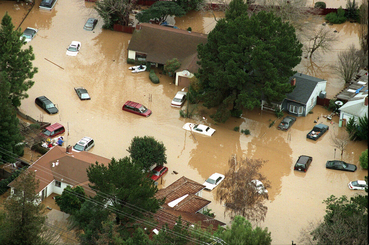
Floods have hit the area before, where communities of color are already struggling to hold on to homes as local prices skyrocket.
 Lauren Sommer/NPR
"I’m thinking back to the places that weren’t ready. Let’s talk about Katrina. That could be us in the next couple of years."
— Leia Grewe, an East Palo Alto resident, with her daughter Heleine Grewe
 Lauren Sommer/NPR
"New development must pay its way.
“There is no reason why the residents or the public should subsidize the benefits that those corporations get."
— Carlos Romero, mayor of East Palo Alto
Leia Grewe’s home in East Palo Alto sits on the edge of the city in the last row of houses before San Francisco Bay begins.
“If we were to get hit, we would be the first,” she says, walking on the road behind her home. In the distance, the water gleams on one side of her house; Facebook’s campus sits on the other.
Flooding didn’t cross Grewe’s mind until her daughter Heleine came home from high school talking about it after meetings of a local youth activism group.
“She used to brush it off,” Heleine says. “We’d come home like, ‘Mom, we’re going to be underwater.’ “
For Heleine, sea level rise is an added layer to East Palo Alto’s long struggle for environmental justice. For decades, the city housed industrial plants, a landfill and a hazardous waste recycling facility. Discriminatory housing practices ensured that nonwhite families were pushed into surrounding neighborhoods. Heleine’s grandparents on one side arrived with many other Black residents after World War II. Her grandparents on the other side emigrated from Tonga.
 Heleine Grewe near her home in East Palo Alto.
Marissa Leshnov for NPR
Heleine Grewe near her home in East Palo Alto.
Marissa Leshnov for NPR
Now, many East Palo Alto residents are fighting to keep their community together, one of the few low-income neighborhoods in a sea of skyrocketing housing prices. Walking down their street, Leia and Heleine Grewe can spot the houses that used to belong to people they knew: cousins, friends, Heleine’s grandmother.
A big flood would only exacerbate the fraying of their community. Many East Palo Alto residents wouldn’t have the resources to recover, and few get information about preparing for the risk they face, says Heleine, who teaches environmental justice classes that cover flooding.
“All one has to do is look at Houston, look at [Hurricane] Katrina and the 9th Ward,” says Carlos Romero, mayor of East Palo Alto. “People of color are fewer these days because they have been displaced permanently from those areas.”
 Floods have hit East Palo Alto a dozen times over the last century.
Marissa Leshnov for NPR
Floods have hit East Palo Alto a dozen times over the last century.
Marissa Leshnov for NPR
Levee project awarded largest federal grant
With as much as two-thirds of East Palo Alto at risk from sea level rise, the city is leveraging its limited resources to help build a new 6-mile levee, the SAFER Bay Project. Until all of it is built, the entire region is vulnerable.
The first section, bordering East Palo Alto, already has $17 million in federal funding secured. East Palo Alto is contributing $5.5 million from its capital improvement fund.
The second phase of the levee, stretching around Facebook’s campus and into Menlo Park, has a bigger price tag. So, the project applied for public funding: a Building Resilient Infrastructure and Communities grant from FEMA, specifically earmarked for pre-disaster preparation.
The grant requires local entities to contribute as well. The utility, Pacific Gas & Electric, would put in $10 million to help protect its transmission lines. Facebook has offered $7.8 million, the amount that would protect its east campus, but not its recent expansion.
“Sea level rise is an issue for everyone living and working in the San Francisco Bay Area due to our close association with a large body of water,” a Facebook spokesperson said in an emailed statement. “We want to do our part to help protect the communities around our campus.” The company declined to be interviewed by NPR.
In early July, FEMA preliminarily awarded the SAFER Bay Project the largest grant of the program — $50 million.
Hundreds of other projects that would safeguard other cities, many in low-income communities, were denied funding by FEMA, whose funding requests were seven times more than the program’s budget. While the grant program sought to prioritize underserved communities, an analysis from Headwater Economics shows the majority of funding will go to wealthier states.
Communities are asking: Is it enough?
Questions of equity had already come up in the local community. Facebook and East Palo Alto would be contributing similar amounts of money for sea level protection, with Facebook’s share only covering part of its campus. Taxpayers would foot most of the bill for the entire levee system.
In meetings, East Palo Alto residents asked: Shouldn’t Facebook be doing more? The company’s arrival had driven up housing costs and increased traffic around them. Now, facing a new threat, why wasn’t Facebook using its enormous wealth to pay more to help its neighbors? residents wondered.
“You’re a lot closer to the water than we are,” Leia Grewe says of the company. “Let us see that you’re just as serious about us as we are about our land.”
Romero, the East Palo Alto mayor, says the challenge is that cities don’t have an established way to charge shoreline developers and companies for sea level rise protection. In his view, those private entities have a larger duty to pay because of the value flood protection adds to their land.
“All of us are going to have to contribute,” he says. “And I think we should indeed figure out a way where corporations, who are making billions of dollars, contribute to this in a significant way because their very livelihood is challenged.”
Cities consider climate fees for developers
Even in wealthier communities, pulling together funding for shoreline protection from private landowners has proven to be difficult. Cities such as San Francisco and Miami went to voters to pass bonds, raising hundreds of millions for flood and sea level rise projects.
Still, San Francisco will need $5 billion for only part of its waterfront. Miami will need $4 billion. So, both cities are looking at raising money from private companies building in the flood zone that bear the highest risk from rising seas.
How to do that is being hotly debated around the country. Most, like San Francisco and Boston, are negotiating with developers individually. But while companies may offer to pay to protect their own buildings, they may not see a need to pay for the nearby roads, power lines and pipes on which they also depend.
“It’s not just that Facebook has a part of their campus that can be flooded,” says Lubell, the UC Davis professor. “They’ve got employees coming from all over the region. And to protect their overall workforce from this, they need to invest in it. And they’ve got plenty of money to do it at a scale that’s much higher.”
The other option is to charge developers directly, either through new taxes or fees. But the idea hasn’t taken off. Cities typically try to attract major employers with tax breaks or other incentives. Adding costs for sea level rise could drive them away, city governments worry.
Menlo Park has that option. In 2016, the city gave itself the power to implement a fee on new developments for their “fair share for the funding of sea level rise projects.” But the city never followed through.
Menlo Park isn’t the only city grappling with sea level rise. Down the shoreline, Google is expanding.
 Google
The company has a vision for building a new campus with offices, housing and green space.
The current levees that protect the area don’t meet federal safety standards.
A major storm could inundate the area in a matter of decades.
 Marissa Leshnov for NPR
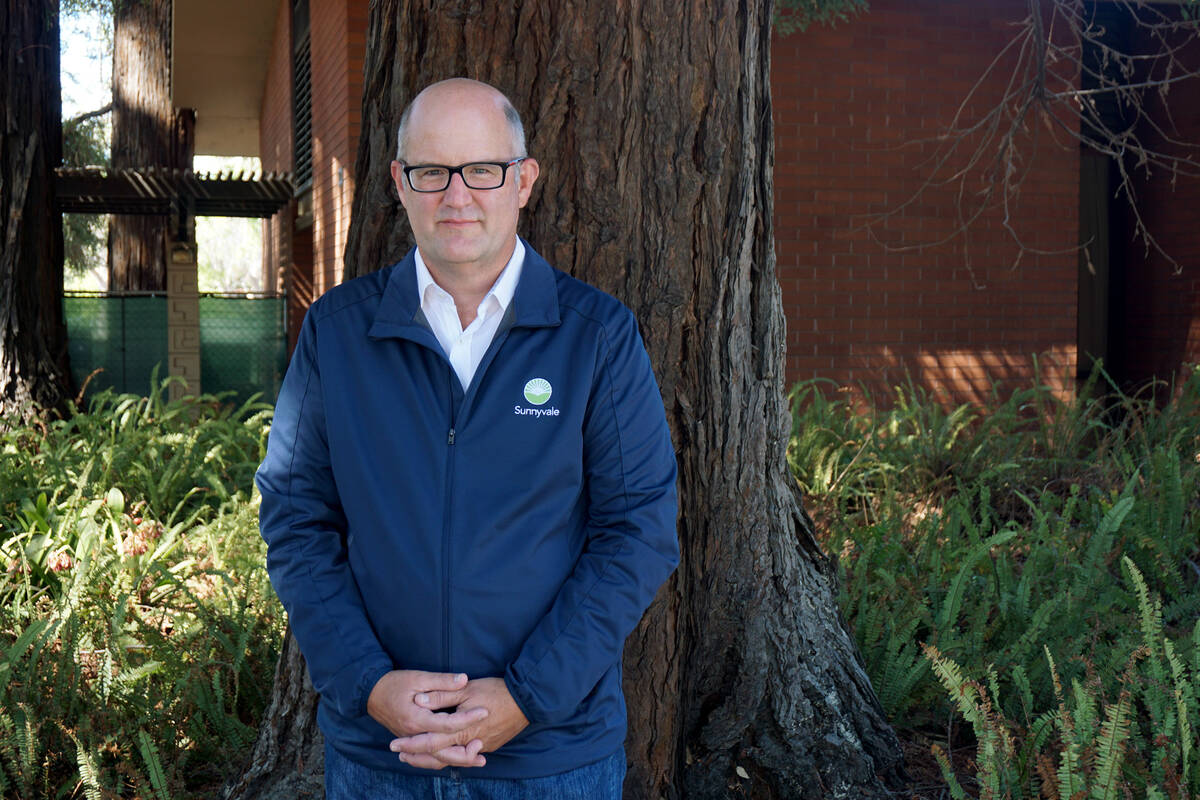
The Sunnyvale City Council is making a plan to allow more development, up to 20,000 housing units and more than 10 million square feet of office space.
 Lauren Sommer/NPR
"The worst-case scenario is that it becomes a flood zone. So I feel this extra burden to be really judicious about where we allow housing to go."
— Russ Melton, Sunnyvale City Council
When residents of Sunnyvale tuned into City Council meetings this spring, they heard discussions about a welcome topic in the Bay Area: additional housing.
Like in the rest of Silicon Valley, home values in the largely suburban city have skyrocketed due to a severe housing shortage. In May, the median home sale price in Sunnyvale was $1.8 million.
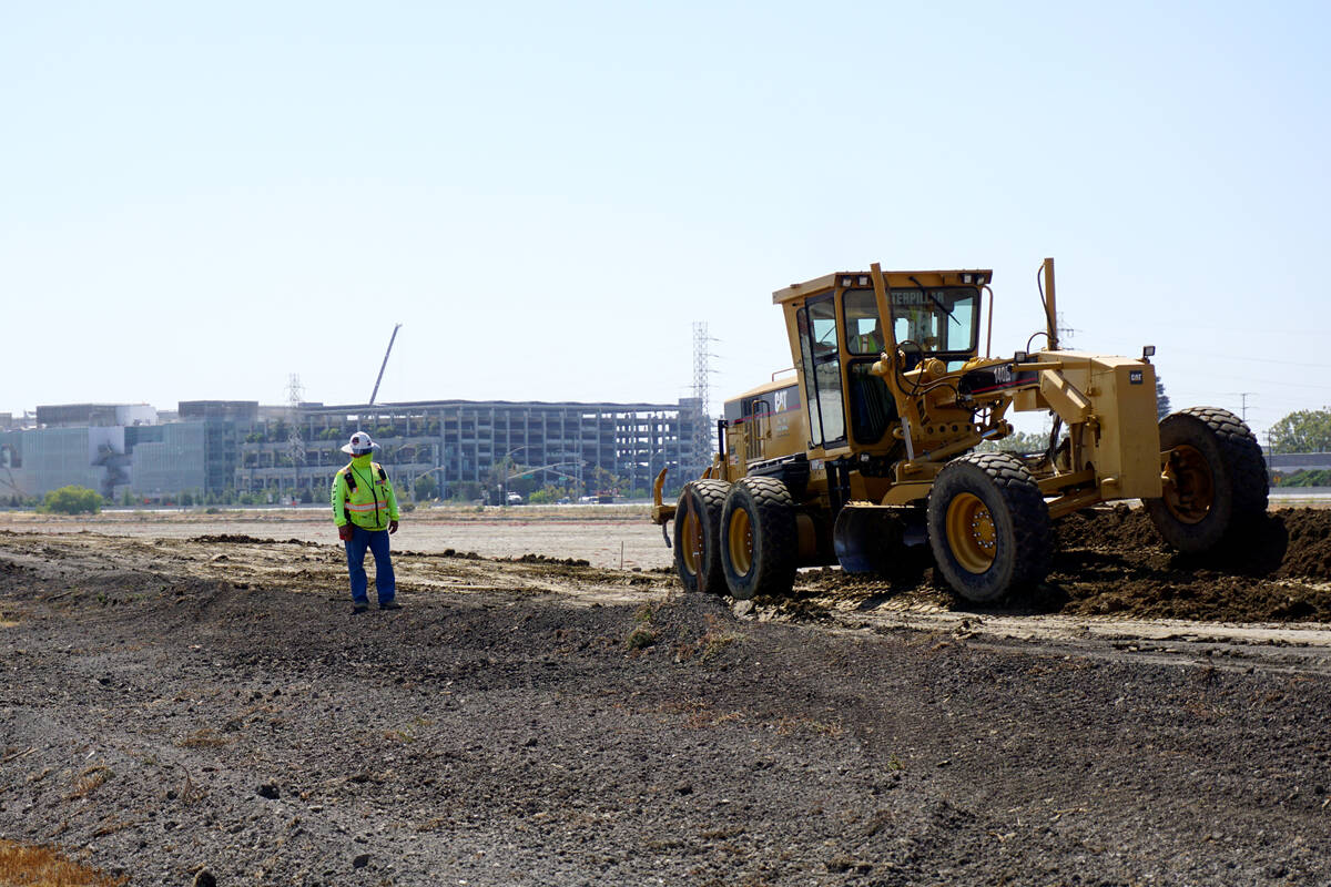
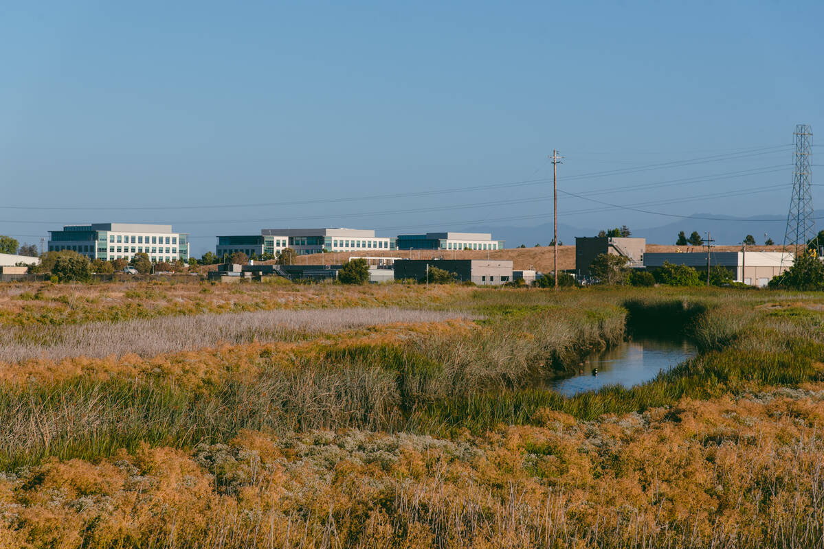
To help alleviate the shortage, Sunnyvale is setting its sights on a 1,300-acre triangle of land known as Moffett Park, sitting on the shoreline of San Francisco Bay. Today, it’s mostly offices, the low-rise buildings separated by wide parking lots.
 Sunnyvale hopes to transform the Moffett Park neighborhood.
Marissa Leshnov for NPR
Sunnyvale hopes to transform the Moffett Park neighborhood.
Marissa Leshnov for NPR
Sunnyvale is reimagining it as an “eco-innovation district,” potentially allowing up to 20,000 units of housing for the first time, including affordable housing, as well as 10.5 million square feet of office and commercial space. New developments would feature green space with biking trails and landscaping for native wildlife. The city is doing an environmental analysis of the plan over the next year.
“One of the most sustainable things you can do is put people where they work and put people where transit is, so this is a huge opportunity,” says Michelle King, principal planner with the city of Sunnyvale.
The vision isn’t just Sunnyvale’s. It’s shared by one of the largest landowners in Moffett Park: Google.
Over the past five years, Google has quietly acquired 75 parcels there, worth almost $3 billion, according to tax records. In 2017, the company wrote a letter to Sunnyvale officials, urging them to rezone Moffett Park to allow housing and higher-density development.
Now, Google has several large construction projects underway, including its Caribbean project, two buildings with sloping green roofs, separated by a landscaped flood control channel. The company says as it expands, it plans to build mixed-use development, as it’s doing around the Bay Area, which combines offices, green space and housing available for the public, including affordable housing.
“We’re incorporating sustainability into everything we do in our developments,” says Jeff Holzman, Google’s director of real estate district development for Sunnyvale. “And we’re doing it to support our employees but also the community and hopefully the environment.”
Some are asking: Why build here at all?
The future of Moffett Park also includes sea level rise, which is expected to inundate a large part of it. Just like nearby cities, Sunnyvale is protected by aging levees that don’t currently meet federal safety standards.
Without those levees, parts of Moffett Park would already be underwater because the land has sunk. Before the arrival of tech companies, Sunnyvale was farmland, home to vast rows of fruit trees. Farmers pumped groundwater for irrigation, causing the land level to drop.
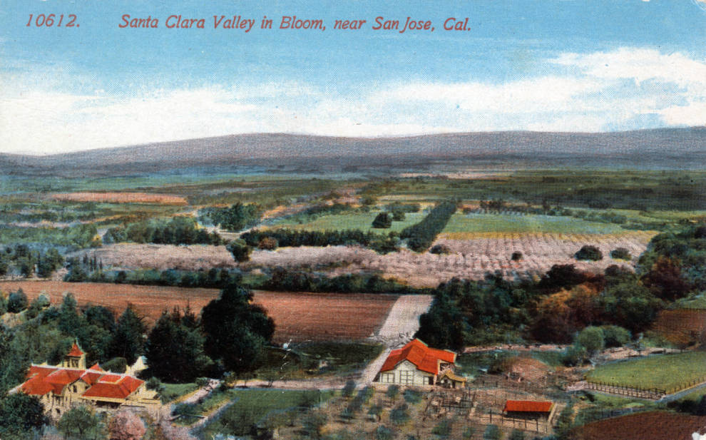 Silicon Valley was once called “the Valley of Heart’s Delight,” home to orchards and farms.
San Jose Public Library, California Room, Historic Postcard Collection
Silicon Valley was once called “the Valley of Heart’s Delight,” home to orchards and farms.
San Jose Public Library, California Room, Historic Postcard Collection
That groundwater, sitting a few feet below the surface in some spots, is another potential source of flooding. As sea levels rise, saltwater doesn’t just flood onshore. It also encroaches underground, pushing up groundwater that’s already there, closer to the surface.
When it rains, shallower groundwater gives runoff nowhere to go.
“It’s like a sponge that’s already soaked and full of water,” says Kristina Hill, associate professor of environmental planning and urban design at the University of California, Berkeley. “So you can’t get any more water into it.”
As a result, rainstorms can cause flash flooding, even forcing water out of sewer drains onto surrounding land. Shallower groundwater can also spread chemicals or contaminants in the soil. Traditional shoreline protection, such as levees, can’t stop it since the water is moving underneath.
“If you spent billions of dollars to build levees and then behind the levee, the groundwater comes up anyway and people are flooded out any time that it rains, that’s going to be seen as a failure,” Hill says.
Faced with this information, some city residents are asking why construction would be permitted in low-lying areas.
“Moffett Park is already heavily developed and is an employment center for the city,” King, the city planner, responded in a November meeting. “The city has a great interest in making sure that Moffett Park is protected in the future and that the investment that’s been put into Moffett Park at this point remains where it is.”
Funding runs short to build a new levee
To protect Moffett Park, Sunnyvale is pinning its hopes on a new levee, like other Bay Area communities. But efforts have already hit hurdles.
The county’s water utility, Valley Water, is leading the South San Francisco Bay Shoreline Protection Project. It would protect 18 miles of shoreline, potentially costing almost $2 billion.
The first section of levee, now nearing construction in a neighboring city after 15 years of planning, has already raised flags about funding.
Congress granted $124 million in 2018 to build the project, but construction bids came back almost double what was expected. Valley Water is covering the shortfall, raising its share of the project’s cost to $269 million, vastly more than it had planned for.
Now, as the agency looks at building two more sections of levee, including Sunnyvale’s, it’s warning that it can’t do it alone. Localities will need to contribute.
“They need to share the responsibility with us,” says Richard Santos, a member of Valley Water’s board of directors. “Because we’re all in collaboration together, and they all receive the benefits. But they all don’t pay. You know, you wanna play, you gotta pay.”
Which comes first: a levee or new buildings?
Sunnyvale is facing a timing problem, too: The levee could take several decades to build, leaving new homes and buildings unprotected against rising seas.
That’s giving some City Council members pause.
“Can I get comfortable with housing in the context of sea level rise?” says council member Russ Melton. “That’s where people live.”
Melton sees the need for more housing. But since there isn’t housing in Moffett Park now, the decision to allow it comes with considerable risk. Before voting, he needs assurances that the levee will be built.
“I’m going to need to see something that is plausible, that is funded, that has the political ability to get across the finish line before we make an irrevocable decision to allow housing in Moffett Park,” he says.
A feasible levee plan is years away. In the meantime, the city is weighing if it should have Google wait on its new construction, where thousands of people will live and work.
Google says allowing its projects to move forward would help ensure everyone is protected.
“I think that all of Sunnyvale needs to contribute to the solution, and I think we’re absolutely going to do our fair share and our part,” says Google’s Holzman.
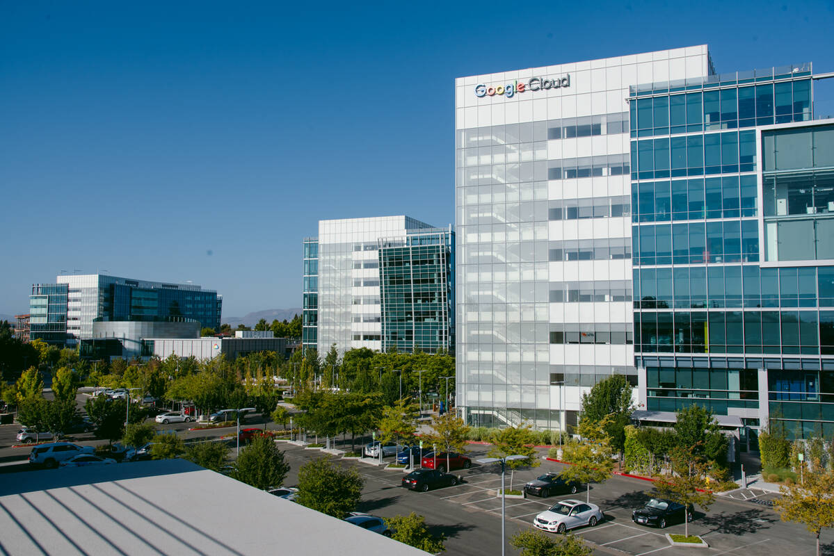 Google is planning a major expansion beyond its Google Cloud campus in Sunnyvale.Marissa Leshnov for NPR
The company says it’s willing to contribute financially to build a levee if other Moffett Park businesses are asked to do the same.
“We kind of need projects like Moffett Park and others to move forward, so that it creates the economic ability to contribute into these solutions,” Holzman says. “The problem is going to exist whether we do more things in Moffett Park or not. And so it gives us a chance to help contribute to what needs to be a community solution.”
Experts say that economic argument can be problematic, because it incentivizes moving more people into harm’s way. Developing in risky areas can help pay for protections there, but what if those protections fail?
“Obviously, the challenge there is you have just put a lot of people at the forefront,” says Linda Shi, professor of city and regional planning at Cornell University. “If a storm surge supersedes what the sea wall there is built for, then those residents are the ones that are actually the first ones to be hit by that much water.”
Google, along with other Moffett Park property owners, is now considering building its own levee to provide flood protection sooner than a larger project would.
Cities have little incentive to say no
Around the country, city councils like Sunnyvale’s are on the front lines of decisions that are becoming increasingly risky in a hotter climate. With control over zoning and land use, they determine who is in the path of future disasters.
Still, cities face an inherent conflict. New development is crucial for their financial health. Responding to a flood disaster, on the other hand, is often paid for by the federal government.
“It’s always the incentive of local governments to build things that bring in sales tax or property tax revenue,” Lubell says, “because that is the main financial mechanism where local governments get their funding.”
That can make it difficult to say no to development. Still, today’s building decisions come with potentially billion-dollar price tags down the road. Local governments are often tasked with maintaining and even raising levees in the future, which is critical to ensuring people remain protected.